
19 Group Members
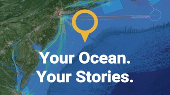
Public
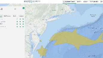
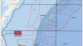
Delaware Demo
Shared resources for 8/14/25
Groups are an opportunity to share information and resources with like-minded ocean users. Create or join a map group that interests you — and invite your colleagues! Maps and drawings can be saved and shared through your group with other registered Portal users.
*Note: MARCO reserves the right to review and remove Groups and content shared within them due to inactivity, inappropriate content or other misuse.
Shared resources for 8/14/25
OSW Group for LBNL users and partners
SISCL STEM SESSION 3
Class group Lab 2
Group for use in class by students at Monmouth University.
ONMS Eastern Region Collaborations
Class group
A space for participants in the Wildlife Conservation Society's August course "Exploring Local Waters: Hudson Canyon" to collaborate on a project and share resources.
This is a marine spatial planning exercise for BY442 Natural Resources and Conservation
Internal group for Portal Data discussion
Wind Energy Team, NJ DEP, Marine Fisheries Administration
This group is for people to practice using the Portal's cool Draw Feature by creating and sharing their own drawings of sea creatures! Best drawings are eligible for fabulous prizes in 3 categories: Whimsical, Realistic and Artistic. Please use the draw feature's "Name" and "Description" boxes to tell us something about your drawing and (optionally) your name or pseudonym!
PEIS Development Avanti w/ ICF
Shared resources for the 12/3/24 class.
Stem Session 5
Attempting to share map drawings
The Spring of 2020 database portal project
Students will use this data based for several different projects and research.
DE DNREC - Data layers to consider while reviewing BOEMs Central Atlantic planning area
Group for lab 2 9/26/2024
SISCL STEM SESSION 4
Investigation the potential link(s) to the sudden, still unexplained deaths of Marine Mammals Off NJ
DEP BPU training session
Fall 2021 Marine Applications of GIS
Map data for the OWRC transmission subcommittee
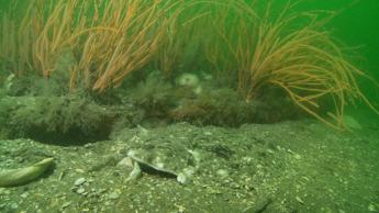
This group for discussing opportunities to create better map layers representing live bottom patch habitats, typically with Astrangia (star coral) and Leptogorgia (sea whip) plus sponges, hydroids, mussels, and diverse invertebrates. Finfish associated with these habitats include black seabass, tautog, summer flounder, sea robins.
This is just a test for a school project
This map group is for partners and stakeholders working to develop an ocean plan for Virginia.
Shared resources for analysis of BOEM OCS Planning Areas.
For the final project in MAR464

Shared map resources for class on 12/1/24.
Map for DNREC to coordinate review of Central Atlantic Call Area
A space for participants in the August 2021 WCS professional development course to share maps and resources.
Activities for February demo.

A survey of state seafloor mapping and data priorities.
Quick links to facilitate discussion
Virginia Central Atlantic Planning Map