



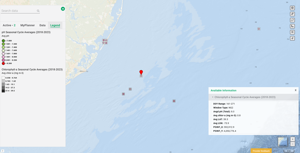
A pair of new map layers representing the seasonal cycle averages for chlorophyll-a and pH at sites in Mid-Atlantic estuaries and ocean areas from 2018-2023 are now available in the Portal’s Water Quality theme.
The datasets were assembled by former Mid-Atlantic Coastal Acidification Network (MACAN) Fellow and Barnard College of Columbia University student Nichole Ruiz in support of MACAN’s research on how pH and chlorophyll-a dynamics may impact each other under increasing pCO2 conditions in the ocean surface and coastal zone. They add to a growing collection of carbonate chemistry and ocean acidification map layers created for the Portal by MACAN to provide information for natural resource management and planning purposes.
Users can find the data by clicking on the “Chlorophyll-a and pH Seasonal Cycle Data (2018-2023)” dropdown in the Water Quality theme. The two layers will automatically activate together when either is clicked. However, users can view them individually by opening the Active tab and muting one or the other by unchecking the circle next to its name.
The maps include data for specified sites in the Mid-Atlantic Bight, Barnegat Bay, Chesapeake Bay, Delaware Bay, and offshore New Jersey. Users can click any of the points on the map for popups containing information about the readings recorded there.
The chlorophyll-a data was derived from National Oceanic and Atmospheric Administration satellite products (view metadata to learn more). The pH measurements were taken from multiple in-situ sources, including gliders, cruises, and continuous monitoring buoys. The following are the sampling campaigns/missions whose data was used for calculating site-specific pH and whose sample coordinates were then used to index for nearby chlor-a pixels:
- CSIO: Citizen Science Initiative: Oyster (data provided by Emily Rivest, Virginia Institute of Marine Science)
- EOTB: Eyes on the Bay (www.eyesonthebay.net)
- National Estuary Program, Barnegat Bay Partnership (data QA/QC’ed by Janet Reimer, provided by Nicole Petersen and Stephen Pacella)
- Rutgers University RU30 Glider (dataset authors: Grace K. Saba, Lori M. Garzio, Laura J. Nazzaro, John Kerfoot)
- NYOS: New York Bight NYOS Glider (data provided by Janet Nye).
- The third NOAA East Coast Ocean Acidification (ECOA3) Cruise
- Delaware Estuary Water Quality Monitoring Program Boat Run data provided by John Yagecic.
For questions about this data or the ocean acidification data layers on the Portal, contact MACAN Co-Coordinator Janet Reimer at jreimer@midatlanticocean.org.