(Updated 6/17/20 to include webinar recording at bottom)
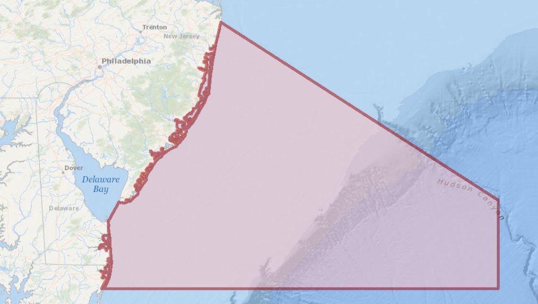
Two new maps showing a U.S. Coast Guard-led New Jersey
Seacoast/Delaware Bay Port Access Route Study (PARS) area and a proposed
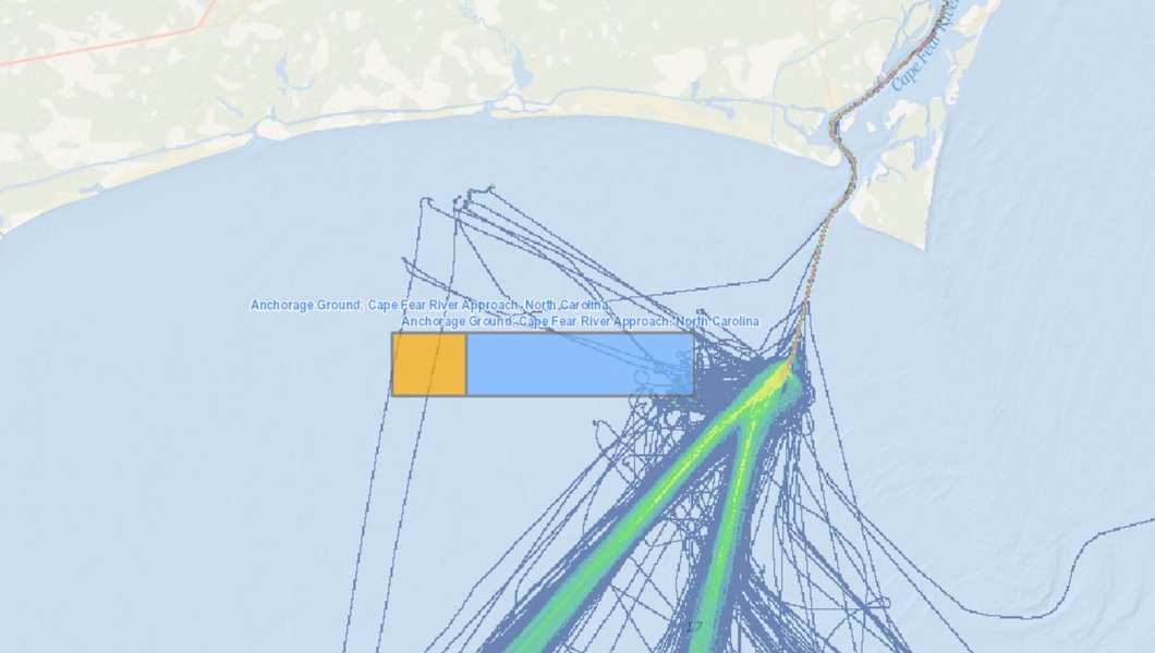
anchorage area near the approach to North Carolina’s Cape Fear River have been
added to the Portal. Both maps can be accessed by clicking on the “USCG
Proposed Areas and Studies” dropdown in Marine Planner’s Maritime theme.

The Coast Guard is conducting the PARS to determine whether existing or additional vessel routing measures are necessary along the seacoast of New Jersey and approaches to the Delaware Bay. The PARS will consider whether existing or additional routing measures are necessary to improve navigation safety due to factors such as planned or potential offshore development, current port capabilities and planned improvements, increased vessel traffic, existing and potential anchorage areas, changing vessel traffic patterns, weather conditions, or navigational difficulty.
The area runs along the shoreline from Long Branch, New Jersey, south to Ocean City, Maryland, and approximately 175 nautical miles seaward. More information about the PARS, including instructions for submitting public comments, can be found on the Federal Register. Click here to view the map in Marine Planner.

The Coast Guard is considering establishing an anchorage ground roughly 8 miles from the approaches to the Cape Fear River in North Carolina and removing, relocating or otherwise modifying the existing Lockwoods Folly Inlet explosives anchorage ground. This action is being examined in response to requests suggesting an anchorage ground is necessary to accommodate current and future vessel traffic, improve navigation safety, and because traditional anchorage areas may be impacted by offshore renewable energy development. The Coast Guard’s consideration of changing or removing the explosives anchorage grounds is based on growth in both the size and draft of vessels that call on the Port of Wilmington and Military Ocean Terminal Sunny Point.
More information about the anchorage ground can be found in the Federal Register. Click here to view the map layer in Marine Planner.
Although North Carolina is not one of the five Mid-Atlantic Regional Council on the Ocean (MARCO) states, several Portal map products cover the state’s coast due to the strong maritime trade and travel relationships between them. The Portal recently published a map showing the area of a North Carolina PARS being conducted to evaluate vessel routing measures along the state’s coast and in the approaches to the Cape Fear River and Beaufort Inlet.
Members of the public are encouraged to use the Portal to
analyze these areas and submit comments containing their observations to the
Coast Guard. The public comment period for the New Jersey Seacoast/Delaware Bay
PARS closes on July 6, 2020, and requests for a public meeting must be
submitted by June 4, 2020. The public comment period for the Cape Fear
anchorage ground closes on July 7, 2020.
Learn More on Webinar
The June 16 edition of our
“How Tuesday” webinar series was dedicated to the New Jersey Seacoast/Delaware Bay
Approaches PARS and proposed Cape Fear River Approach Anchorage Area. Guest presenters Jerry Barnes and Matt Creelman of the Coast
Guard's Fifth District provided additional information on the study and
anchorage area, demonstrated the new maps, and discussed how the Portal can be
used to analyze the sites and inform public comments.

