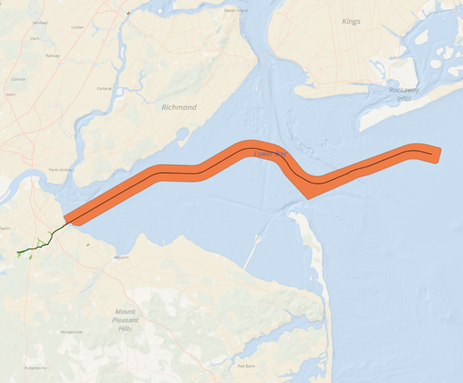
A pair of new map layers on the Portal show the approximate route of the proposed Transcontinental Gas Pipeline Co. (Transco) – Northeast Supply Enhancement (NESE) project, which would run from Long Island to Middlesex County, New Jersey.
The NESE project is a proposed expansion of Transco’s existing system from Pennsylvania through New Jersey to New York. It would provide 400,000 dekatherms per day of incremental capacity to Transco’s existing Rockaway Transfer Point, located approximately 3 miles offshore of the Rockaway Peninsula in Queens.
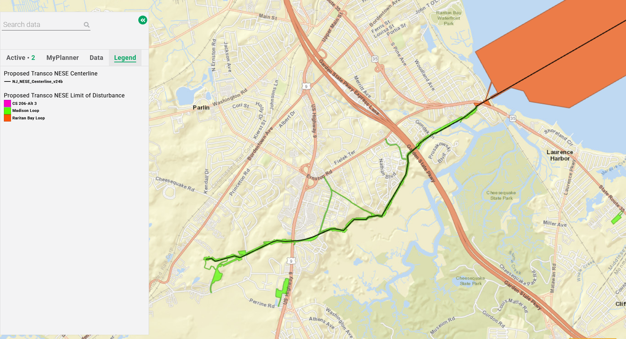
The Proposed Transco NESE Limit of Disturbance and Centerline layers can be accessed by clicking on the “Submarine Cables and Pipelines” dropdown in the Maritime theme. They are two of five data layers available for download, along with additional project documentation, on the New Jersey Department of Environmental Protection (NJDEP) website. Users may also click here to view the two layers in combination with the Portal’s Pipeline Areas layer.
The proposed NESE project would involve the construction and installation of three components in New Jersey: 1) construction of a new gas-fired compressor station (CS 206) with connecting discharge piping; 2) the Madison Loop; and 3) the Raritan Loop (offshore). Click the Legend tab to view those features on the map.
On Nov. 7, 2025, the NJDEP Division of Land Resource Protection approved permits for the Transco NESE project. Specifically, the Division approved a Freshwater Wetlands Individual Permit, Coastal Wetlands Permit, Flood Hazard Area Individual Permit, Flood Hazard Area Verification, In-Water and Upland Waterfront Development Permits and a Water Quality Certificate. View the permit decision here.
For more information about the project, visit the Northeast Supply Enhancement page on the Williams company website.